Geospatial Data

Our approach
At Sproutt, we use Geographic Information Systems (GIS) to help you visualise and analyse spatial data, providing valuable insights for your projects.
GIS allows us to map, track, and manage geographic data, offering a detailed view of everything from land use and transport systems to natural resource management.
Whether you’re planning urban development, managing environmental resources, or optimising transportation networks, our GIS solutions offer improved data accuracy, clearer visualisations, and enhanced transparency.
LEARN MORE
The Sproutt difference
What makes Sproutt unique is our ability to deliver GIS solutions tailored to your specific needs.
We don’t just collect data – we transform it into practical tools that you can use for everything from spatial analysis and mapping to real-time data access via cloud-based applications.
Our expertise spans a wide range of GIS applications, from digitising maps to creating customised systems that allow you to make sense of complex geographic data. By integrating GIS with our engineering and advisory services, we provide a complete solution that enhances decision-making and operational efficiency.
Sproutt is an Esri Certified Partner which reflects our commitment to excellence in GIS and our goal to be industry leaders in this field.
Better outcomes
By working with Sproutt’s Geospatial & Data team, you’ll gain the ability to manage spatial data effectively and leverage it to make more informed, data-driven decisions and solve complex problems through the creation of maps, 3D visualisations, and other graphic representations of data.
This real-time access to interactive data will ultimately improve the efficiency and success of your projects.
Service offerings

01
Map Digitisation
Convert physical maps or raster images into data-rich digital formats for integration and decision-making.

02
Online Cloud Applications
Develop browser-based applications using data visualisations on the ArcGIS platform.

03
Asset Database Development
Create and manage asset registers with integrated GIS capability.

04
Spatial Analysis
Combine or process data layers for distance and direction measurements, overlay and intersection analysis, network analysis, and terrain analysis.

05
Mobile Data Capture
Capture real-time data for field surveys, asset management, business operations and environmental monitoring.

06
Enterprise GIS Integration
Create custom GIS applications and tools tailored to your organisation.

07
Geospatial Program
Integrate all Geospatial offerings into a managed service that provides holistic and ongoing support.
Related projects
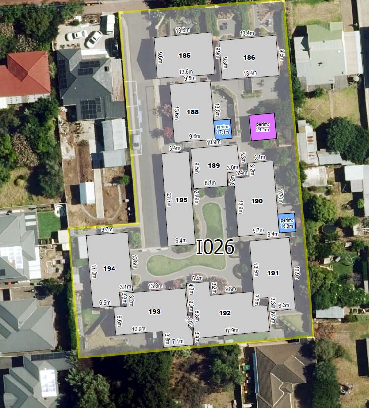
Aerial Gutter Measurements
Aerial Gutter Measurements

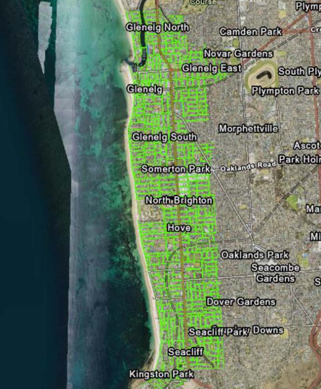
Electric Vehicle Infrastructure Registration
Electric Vehicle Infrastructure Registration

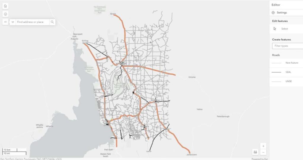
GIS Support
GIS Support
Transport Condition Audits (Roads, Footpaths, Kerbs, Kerb Ramps)
Transport Condition Audits (Roads, Footpaths, Kerbs, Kerb Ramps)
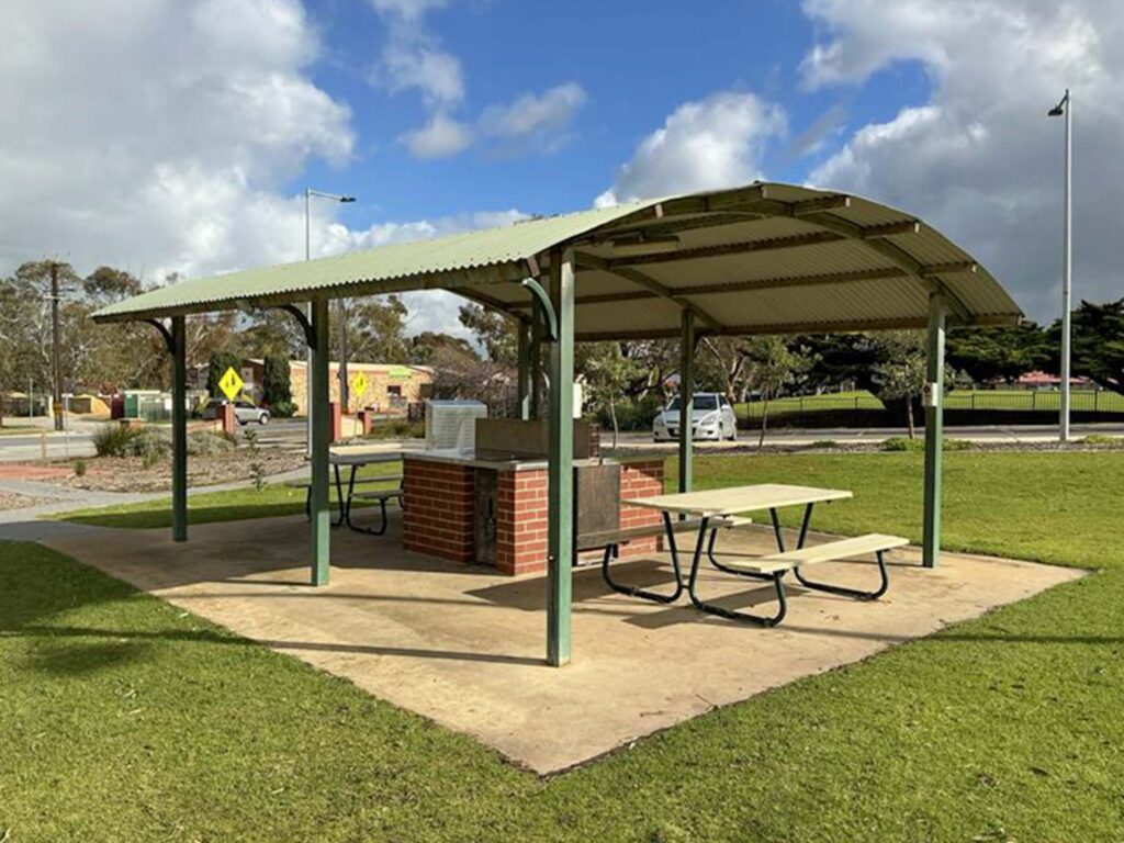
Open Space Asset Condition Audit
Open Space Asset Condition Audit
Footpath Condition Audits
Footpath Condition Audits

Open Space Asset Data & Condition Audit
Open Space Asset Data & Condition Audit
ArcGIS Online Implementation for Road Grading Workflow
ArcGIS Online Implementation for Road Grading Workflow

Public Lighting Condition Audit
Public Lighting Condition Audit
Ready to build together?
Driven by a commitment to long-term sustainability and stewardship, we tackle the most complex challenges facing Australia’s built and natural environments, combining strategic thinking with innovative solutions to best serve communities, people, and the planet.